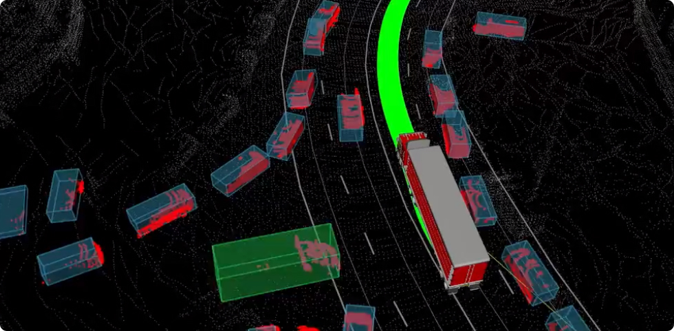
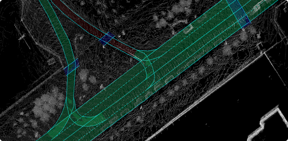
Technology

Localization

Self-driving starts with understanding where your truck is.
We should not rely on GNSS because of dead zones, also
road markings are often missing or incorrect. Our
technology uses lidars and radars with precise HD mapping
to localize autonomous trucks with 10cm accuracy.

Simulation

- long range 360 deg. detection: up to 1000 m

- precise neuro-based trajectory estimation

- lidar + camera + radar fusion for operating
   in severe weather conditions (snow, fog,
   heavy rain) and/or night time

AI

We develop and use many deep-learning models to perform
such difficult tasks as object detection, traffic light
recognition, road marking detection. Our technology allows
trucks to see vehicles and pedestrians several hundreds
meters away. With incredible AI prediction we are able to
react 10 times faster than a human driver.

Mapping

Trucks moving from point A to B use our own semantic map
with many layers: road lanes, traffic lights, speed limits,
crosswalks etc. In Moove we use AI and Moove Map Editor
to provide the most accurate maps of routes. We detect
road signs and markings using recorded lidar and camera
data, as well as satellite images, then our editors manually
review automatically created maps. Maps are automatically
updated whenever changes occurs: new construction zones
or road markings changes.

Hardware

Each Moove autonomous truck is equipped with specially
designed and built computer modules, set of lidars, radars
and cameras. We developed Moove Truck Sensor Kit (TSK)
to convert regular truck to self-driving truck just for
several hours. Our hardware installation does not interfere
in trucks drive-safe features such as ABS, ESP etc.,
communicating with vehicle through CAN interface.